Summary of Voyage #1: Marine MT Measurements

The focus of our first series of research voyages, between November 2022 and January 2023, was the deployment and recovery of marine MT (magnetotelluric) devices at Whakaari (White Island).
The team from the Raranga Whāriki Papa Moana | Beneath the Waves programme are undertaking a series of research voyages to learn more about the anatomy of the Tūhua (Mayor Island) and Whakaari (White Island) volcanoes.
This article summarises the key activities undertaken in late 2022 and early 2023 aboard the RV Tangaroa and MV Toanui respectively. The research goal was to deploy specially designed marine MT devices on the seabed surrounding Whakaari.
These ocean-bottom sensors passively measure natural electric and magnetic fields in the Earth’s crust. MT (magnetotelluric)(external link) data allows us to model the subsurface electrical resistivity structure to ~10 km depth. Because rocks that are molten or contain high-temperature fluid are orders of magnitude more conductive than ‘normal’ rocks, these marine MT data will allow us to image the magmatic and hydrothermal plumbing system beneath Whakaari.
NOVEMBER 2022: RV TANGAROA (TAN2214)
Step 1: Mobilisation
The science crew on the TAN2214 voyage comprised five personnel from GNS Science and five personnel from Scripps Institution of Oceanography (SIO).
To measure MT data on the sea‐bed, we partnered with SIO at the University of California, San Diego. Professor Steven Constable leads a Marine EM (electromagnetics) laboratory at SIO, which pioneers new technologies for exploring the crust and mantle beneath the oceans using marine electromagnetic techniques, including the MT method.
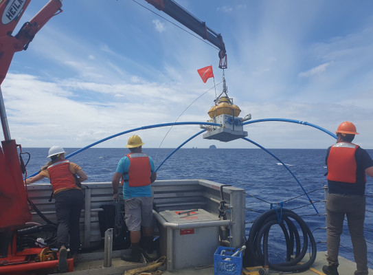
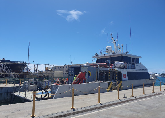
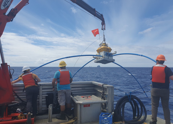
SIO supplied 40 marine-MT receivers, which are completely autonomous seafloor data logging systems. These MT systems and sea anchors were mobilised by the science and vessel crew onto the RV Tangaroa at the Ports of Auckland, and secured on deck.
Step 2: Deployment
During transit from Auckland to Whakaari, the science crew prepared the marine MT systems, including SIO programming and starting the data loggers, in advance of arriving on station for deployments.
Over 24 hours, in the ocean surrounding Whakaari, the science and vessel crew deployed 40 systems, working together to guide the marine MT instruments safely to sea, using the ships crane. We were lucky to have mostly fine weather and <1 m swell with winds averaging ~10 kts.
Following successful deployment, the RV Tangaroa and crew transited to Wellington.
JANUARY 2023: MV TOANUI
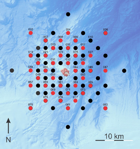
The battery supply in the data loggers was sufficient to record MT data on the seabed for four weeks. Thus, the marine MT systems deployed on TAN2214 were recovered and re‐deployed at additional locations around Whakaari a few weeks later, using the MV Toanui (black dots in the Figure below).


Step 3: Re-deployment & Recovery
In January 2023, a team of six (1x GNS Science, 5x SIO) undertook two week-long voyages on the MV Toanui.
The first week involved picking-up the MT systems deployed on TAN2214. and re-deploying them. This involved shifting the MT systems one-by-one, and when on deck, the systems were serviced (e.g. batteries changed, data downloaded and checked, and logger reprogrammed) before re-deploying.
The second week, all 40 systems were recovered. This was undertaken in two batches of 20, due to the smaller size of the MV Toanui, with partial disassembly on deck.
Deployment of these marine MT systems require a non‐magnetic anchor, which is made from concrete and stainless‐steel to enable the systems to descend to the seabed, and to ensure the instruments remain fixed in location during recording. Retrieval of these systems involves sending an acoustic signal to a burn‐wire mechanism, which releases the strap holding the instrument to the anchor and allows it to ascend to the surface for recovery. This method leaves the anchor behind so appropriate permits were in place for this work.

ANALYSIS
Excellent quality MT data were recorded from these deployments. The marine MT data recorded is being combined with additional marine MT data measured around Whakaari to image the subsurface electrical resistivity structure and infer characteristics of the underlying magmatic and hydrothermal systems beneath this active volcano.
Initial analysis of the MT data to date show evidence for low-conductivity at shallow depth (a few km’s) around Whakaari, and to the south towards the Calypso Hydrothermal system. This is consistent with high-temperature fluids and hydrothermal alteration, which would both lower the electrical conductivity of rocks in these areas. At greater depths, the data suggest that the underlying magmatic system is located more to the northwest of Whakaari, something that our additional measurements are designed to investigate further.
VOYAGE INFORMATION
RV Tangaroa (TAN2214)
Dates: 14-21 November 2022
Lead Organisation: GNS Science
Voyage Leader: Ted Bertrand (GNS Science)
Deputy Voyage Leader: Steven Constable (Scripps Institution of Oceanography)
MV Toanui
Dates: 16-27 January 2023
Lead Organisation: GNS Science
Voyage Leader: Ted Bertrand

Ted Bertrand
Geophysicist