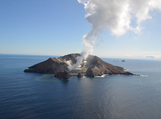
Hyperspectral Survey of Whakaari
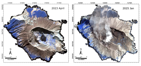
In January 2025, the research team completed an airborne hyperspectral survey over Whakaari | White Island, showing that, since the 2019 eruption, much of the island is covered by new tephra deposition at various thicknesses, mostly within the crater floor.
What is hyperspectral imaging?
Hyperspectral imaging 'sees' beyond the visible spectrum. It measures light reflected from the Earth's surface at hundreds of narrow and overlapping spectral bands. This data provides a detailed compositional analysis of the Earth’s surface, and the materials can be identified based on their unique spectral signatures (i.e. the way they absorb and reflect light at different wavelengths).
Searching for hydrothermal alteration
We are using hyperspectral imaging to search for hydrothermal alteration, which is the chemical and physical changes in rocks caused by interaction of hot, mineral-rich fluids, and leading to the replacement of original minerals with new ones. Hydrothermal alteration influences the stability of volcanic structures, so mapping hydrothermal alteration provides information on flank stability and helps to assess volcanic hazards.
We have used hyperspectral remote sensing to understand hydrothermal systems on New Zealand volcanoes Mt Tongariro and Mt Ruapehu, and we have also applied this technique in geothermal and mineral exploration projects.
In January 2025, we flew a hyperspectral survey over Whakaari. The hyperspectral sensor was mounted on a low-flying, fixed-wing aircraft that flew a grid pattern, and the images collected have detailed spectral information associated with every image pixel, allowing us to interpret and map hydrothermal alteration minerals on the surface. The research team included Gabor Kereszturi , Dan Sturgess and Craig Miller.
Data processing
The data collected is then processed to map deposits covering the surface.
Early spectral analysis shows that, much of the island is now covered by new tephra, deposited from small-scale eruption during the heightened activity in 2024 , mostly within the crater floor. Tephra are rock fragments and particles ejected by a volcanic eruption.
We have access to hyperspectral data from before 2019, and are currently working on new spectral change detection methods to be able to use the pre- and post-eruption hyperspectral for mapping out the tephra deposits. Tracking minor tephra deposition and their mineralogy can allow us to reconstruct what is going on in the volcanic conduit and to see processes that can lead to eruptions.