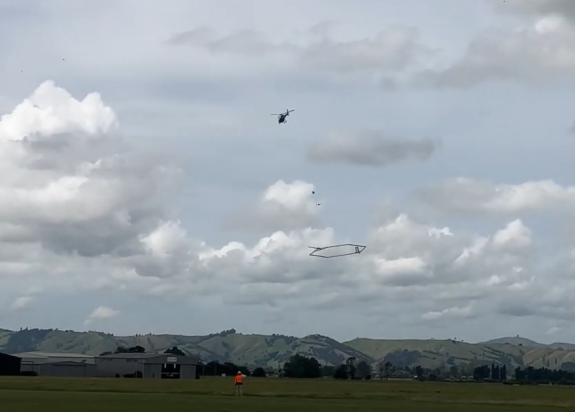
SkyTEM in action
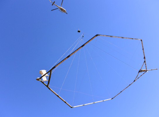
In February 2023, we flew SkyTEM, an airborne electromagnetic system over Tūhua and Whakaari island volcanoes.
The SkyTEM is a helicopter-born system that measures earth’s electrical conductivity to a depth of several hundred meters. The transmitter loop (~340 m2) and receiver sensor are suspended below the helicopter and a pre-mapped series of parallel lines is flown over each island (not including the active Whakaari crater). A skilled pilot ensures the supporting ropes retain the correct tension to ensure the transmitter loop stays horizontal.
You can watch videos of SkyTEM in action from different perspectives:
- Picking up and putting down the transmitter/receiver loop(s) and flying with it(external link)
- SkyTEM flying over Whakaari White Island, viewed from a boat(external link)
- View from inside the helicopter as it flies along the Whakaari coastline(external link)
The transient electromagnetic (TEM) geophysical method is used to non-intrusively , obtaining subsurface electrical resistivity-conductivity data. Factors affecting conductivity include fluid type and saturation, rock porosity/permeability, and rock matrix (fresh vs clay rich). We are looking for areas of high conductivity/low resistivity and low magnetic signature, which indicates hydrothermal alteration that may be susceptible to land sliding.
The TEM data allows us to interpret the near-surface geology and is one of the geophysical survey techniques(external link) the programme is using to locate magma reservoirs, hydrothermal systems, faults, areas of weak and strong rock, as we build a 3D model of these island volcanoes.